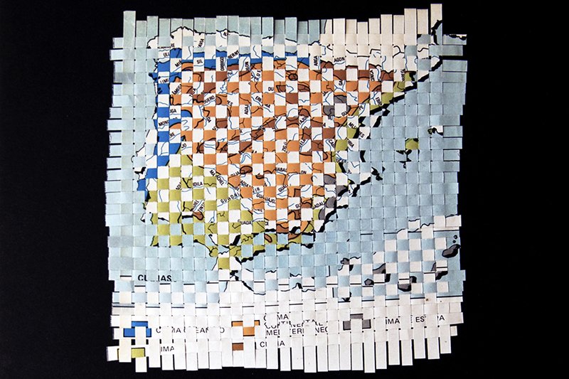
Physical-Political Map
2014 / Woven maps / Series of three units, 21.7 × 29 cm
One territory can be represented by many different kinds of maps: they can be political, geographical, topographical, geological, climatic, meteorological, and so on. In this work, I have woven together a range of themed maps in order to show, ironically, the issues that arise when trying to organise the multitude of geolocated data about any given territory — this data, layer by layer, comprises today’s systems of geographical information. The reading and interpretation of such an overwhelming amount of data can end up giving us a distorted image of reality.